

Stai seguendo
Impossibile seguire l'utente.
Questo utente non consente agli altri utenti di seguirlo.
Stai già seguendo questo utente.
Il tuo piano di abbonamento ti consente un massimo di 0 segui. Cambia abbonamento qui.
Non segui più
Impossibile non seguire più l'utente.
Hai consigliato .
Impossibile consigliare l'utente.
Si è verificato un problema. Aggiorna la pagina e riprova per piacere.
Email verificata.

lahore,
pakistan
Attualmente sono le 11:26 PM qui
Registrato il luglio 13, 2017
0 Consigli
Muneeb A.
@MUNEEBAAMIR
0,0
0,0
0%
0%
lahore,
pakistan
NA
Lavori completati
NA
Nel budget
NA
Nei tempi previsti
NA
Tasso di riassunzione
Geospatial Expert
Contatta Muneeb A. per il tuo lavoro
Accedi per discutere i dettagli via chat.
Portfolio
Portfolio


Preparation of Digital Elevation Model
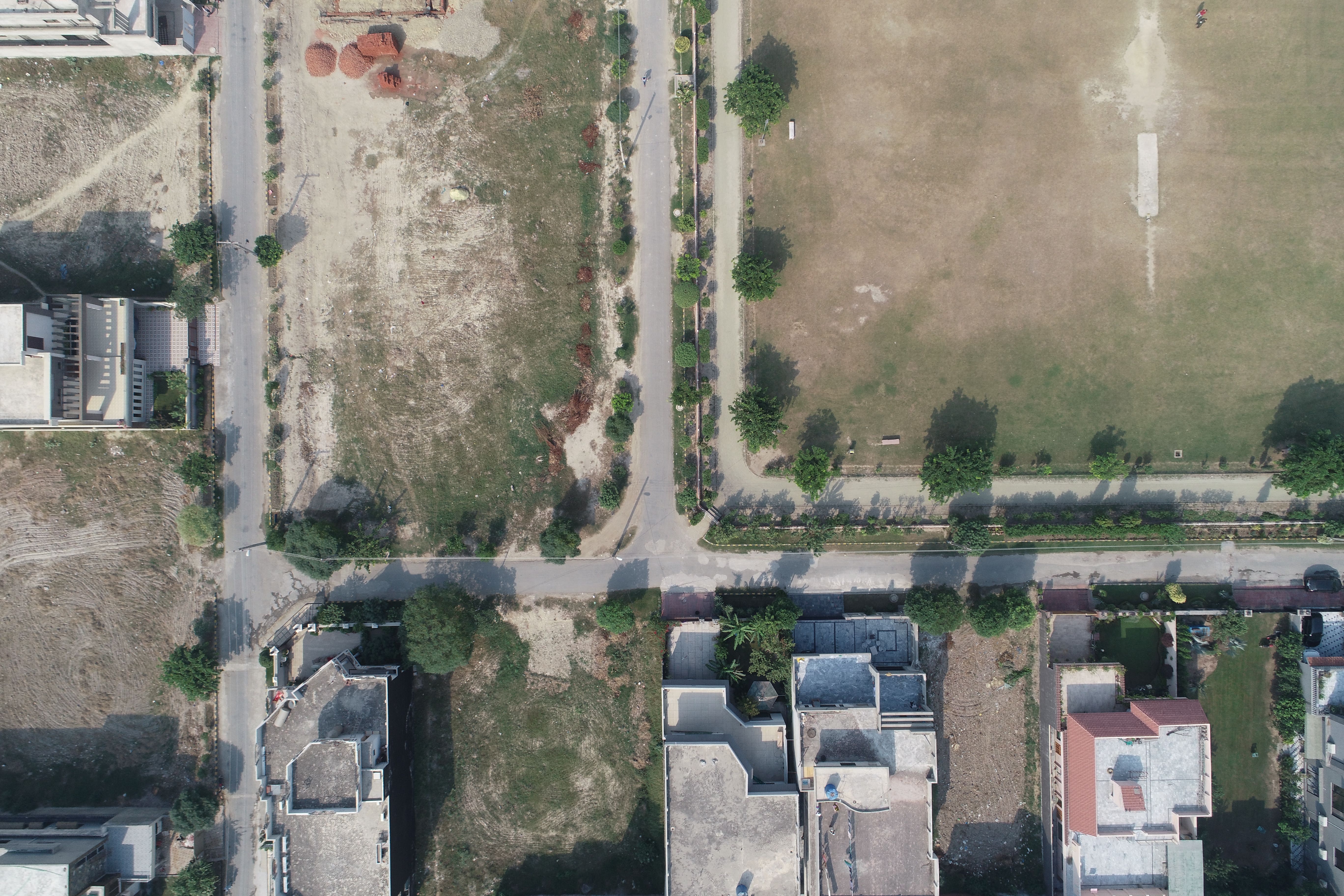

Drone Mapping

Drone Mapping

Drone Mapping
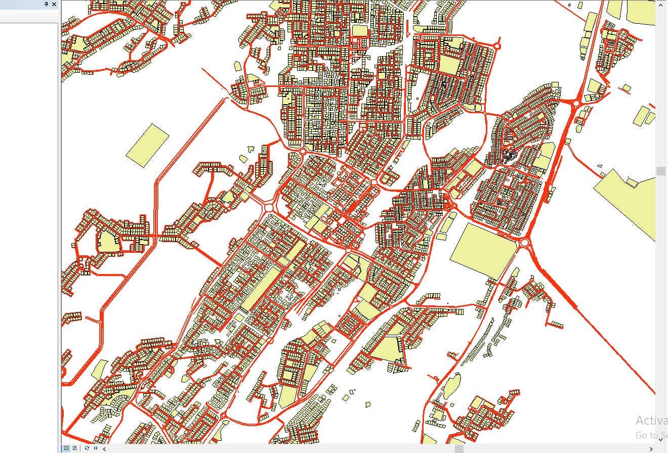

CAD to SHP Files

CAD to SHP Files
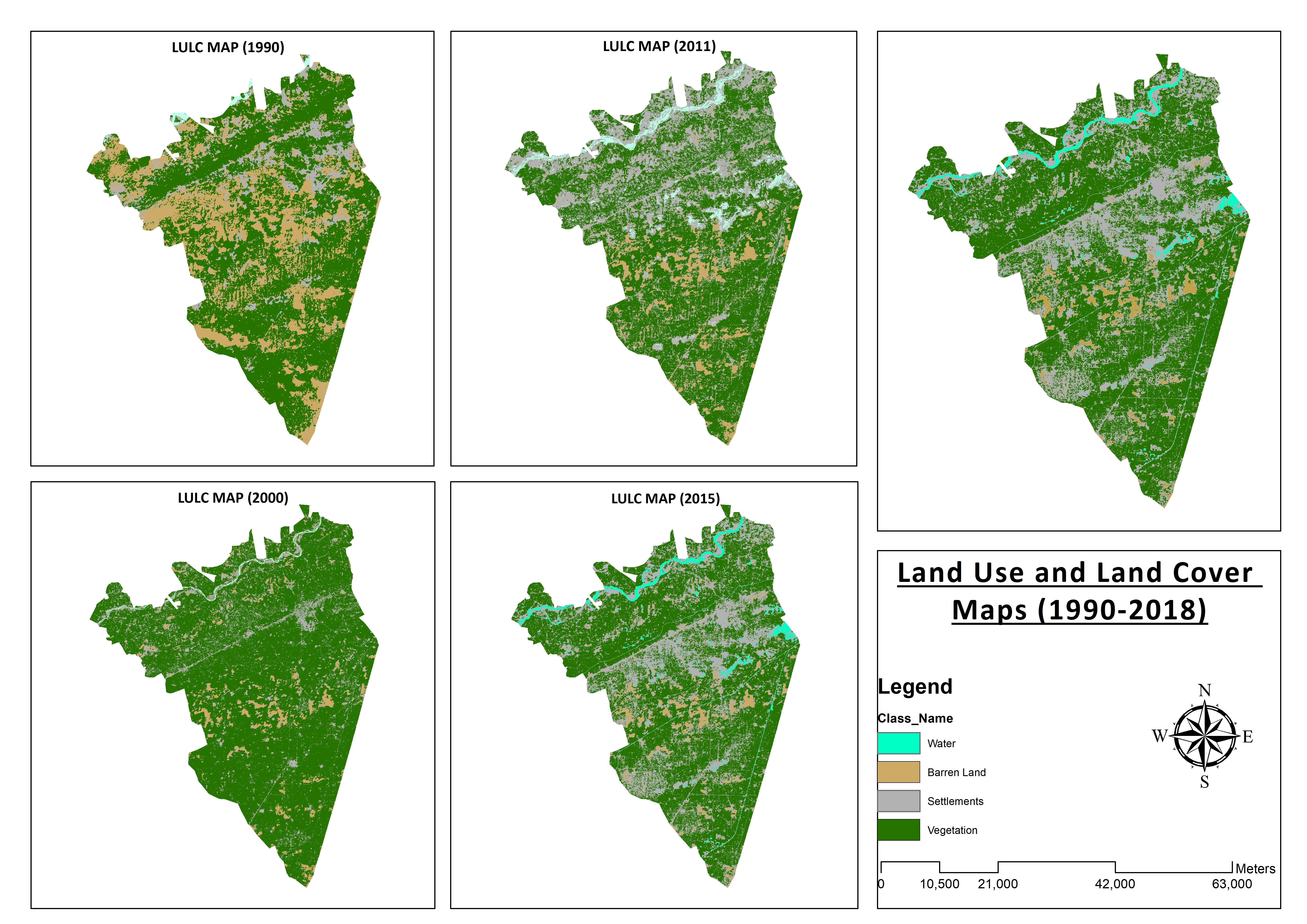

Land Use and Land Cover Maps
Preparation of Digital Elevation Model
Drone Mapping
Drone Mapping
Drone Mapping
CAD to SHP Files
CAD to SHP Files
Land Use and Land Cover Maps
Valutazioni
Modifiche salvate
Nessuna valutazione da vedere qui!
Esperienza
Remote Sensing and GIS Analyst
set 2018 - ott 2019 (1 anno, 1 mese)
Developed, integrated and Implemented GIS and Geodesy based Topographic Survey Plans under different Hydro-Power Projects in Northern Pakistan, Extension of Canal Projects to increase its capacity in Sindh-Balochistan, Analysis of Suitable Site Selection for different development sites by using Drone for Aerial Mapping and their detailed pre-feasibility studies with different softwares, to analyse and interpret spatial data to produce interacting Maps and Reports while ensuring quality control.
Research Associate GIS
ott 2015 - ott 2018 (3 anni)
Deployed GIS-based system under Urban Immovable Property Tax (UIPT) for Punjab Excise & Taxation Department. Provided comprehensive support in creating the system while take advantage of software suites like ArcGIS Suite and ERDAS Imagine. Prepared communicating maps to help surveyors in Analyzing geo-spatial data to verify it during ground truthing. Created shapefiles to merge topographical data with external data through layering process.
Formazione
Master of Philosophy in Geographic Information System
(2 anni)
Bachelors in Geographic Information System
(4 anni)
Certificati
MS-Office
TEVTA
2017
MS-Office Certification in MS-Word, Excel and Power Point.
Pubblicazioni
Analysis of Flood Damage Assessment through Different Satellite Datasets in Southern Punjab,Pakistan
International Journal of Innovations in Science & Technology
RS and GIS techniques can achieve the objectives and significant analyses through visual interpretations. These techniques are also used to identify the flood affected regions. The study site was examined by applying supervised classification determining that 16900.96 Hectors of agriculture land was damaged while Sparse Riverine Forest had the area 44.52 hectors. The damaged built-up area was 1805.78 Hectors.
Estimation of Net Rice Production by Remote Sensing and Multi Source Datasets
Sarhad Journal Of Agriculture
Estimation of net crop production before harvest enables agronomists and decision makers to determine the volume of grain precisely. Yield estimation is one of the challenging tasks which is significant to evaluate accurately for farmers. This research was conducted in eastern Punjab Pakistan by incorporating yield/area as reported by Crop Reporting Service Department along with open source satellite datasets.
Contatta Muneeb A. per il tuo lavoro
Accedi per discutere i dettagli via chat.
Verifiche
Competenze principali
Cerca freelance simili
Cerca vetrine simili
Invito inoltrato!
Grazie! Ti abbiamo inviato tramite email il link per richiedere il tuo bonus gratuito.
Non è stato possibile inviarti l'email. Riprova per piacere.
Impossibile copiare negli appunti. Riprova dopo aver modificato le tue autorizzazioni.
Copiato negli appunti.
Caricamento anteprima
Autorizzazione per la geolocalizzazione concessa.
La tua sessione è scaduta ed è stato effettuato il log out. Accedi nuovamente per piacere.