
Stai seguendo
Impossibile seguire l'utente.
Questo utente non consente agli altri utenti di seguirlo.
Stai già seguendo questo utente.
Il tuo piano di abbonamento ti consente un massimo di 0 segui. Cambia abbonamento qui.
Non segui più
Impossibile non seguire più l'utente.
Hai consigliato .
Impossibile consigliare l'utente.
Si è verificato un problema. Aggiorna la pagina e riprova per piacere.
Email verificata.

guelmim,
morocco
Attualmente sono le 12:28 PM qui
Registrato il maggio 16, 2017
1
Consiglio
Ayoub L.
@ayoubGis
4,2
4,2
100%
100%
guelmim,
morocco
100%
Lavori completati
100%
Nel budget
100%
Nei tempi previsti
20%
Tasso di riassunzione
GIS, RS & Territorial Development
Contatta Ayoub L. per il tuo lavoro
Accedi per discutere i dettagli via chat.
Portfolio
Portfolio

Spatial analysis

Spatial analysis

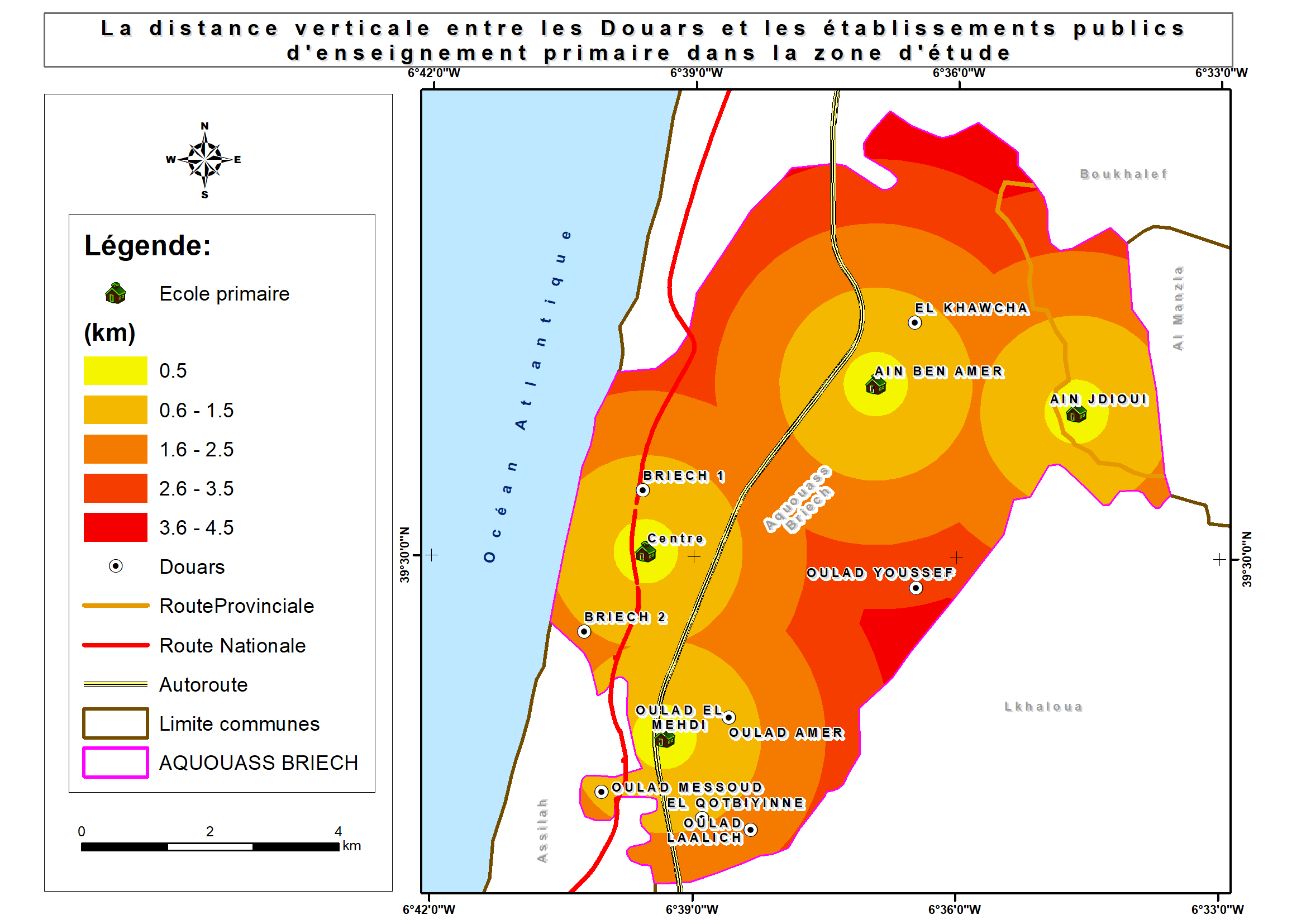
Shaded relief map
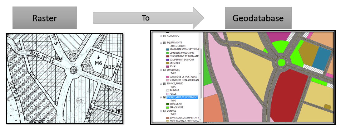

Raster to Geodatabase
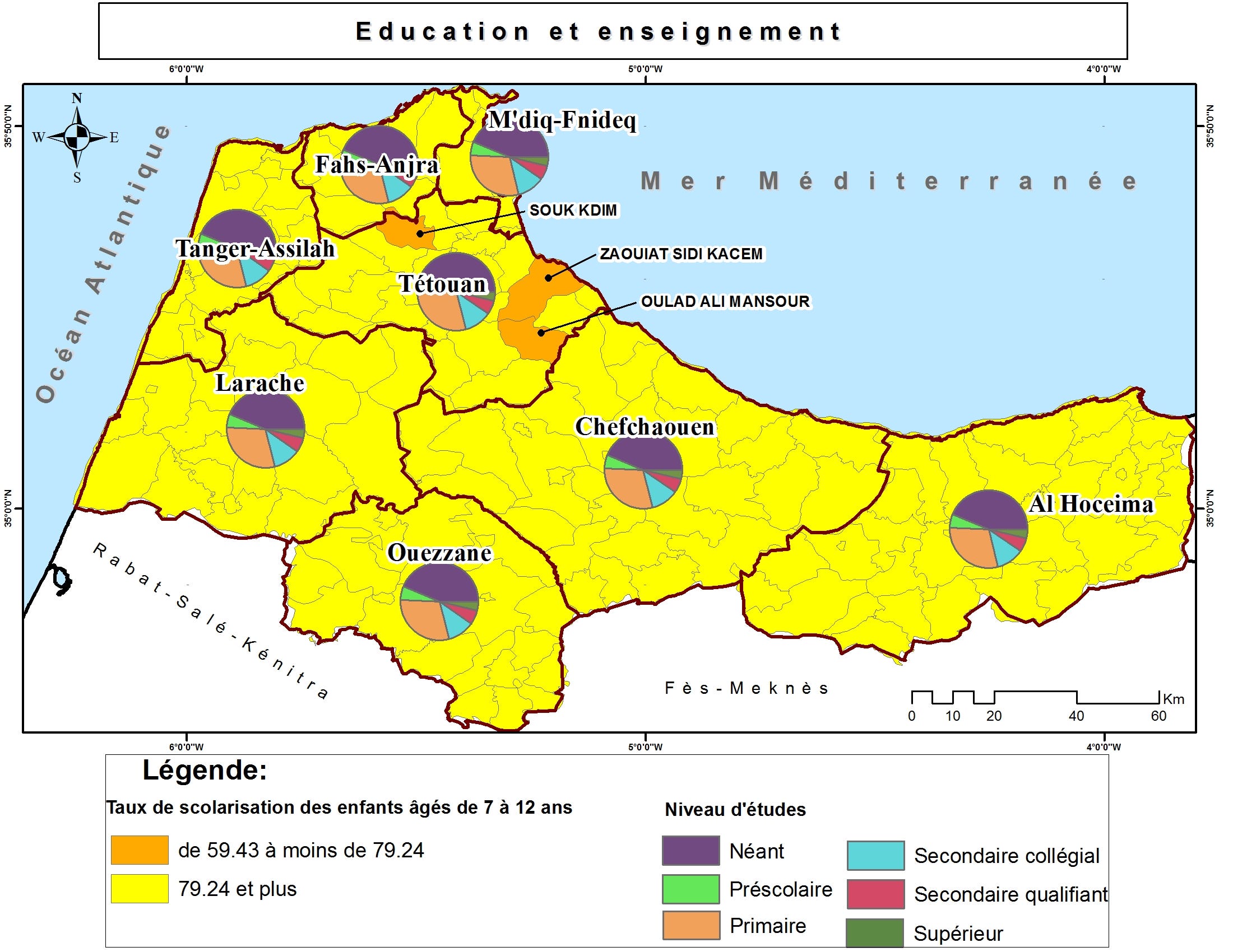

Thematic maps

Thematic maps

Thematic maps

Thematic maps

Brochure with Business Card

Brochure with Business Card
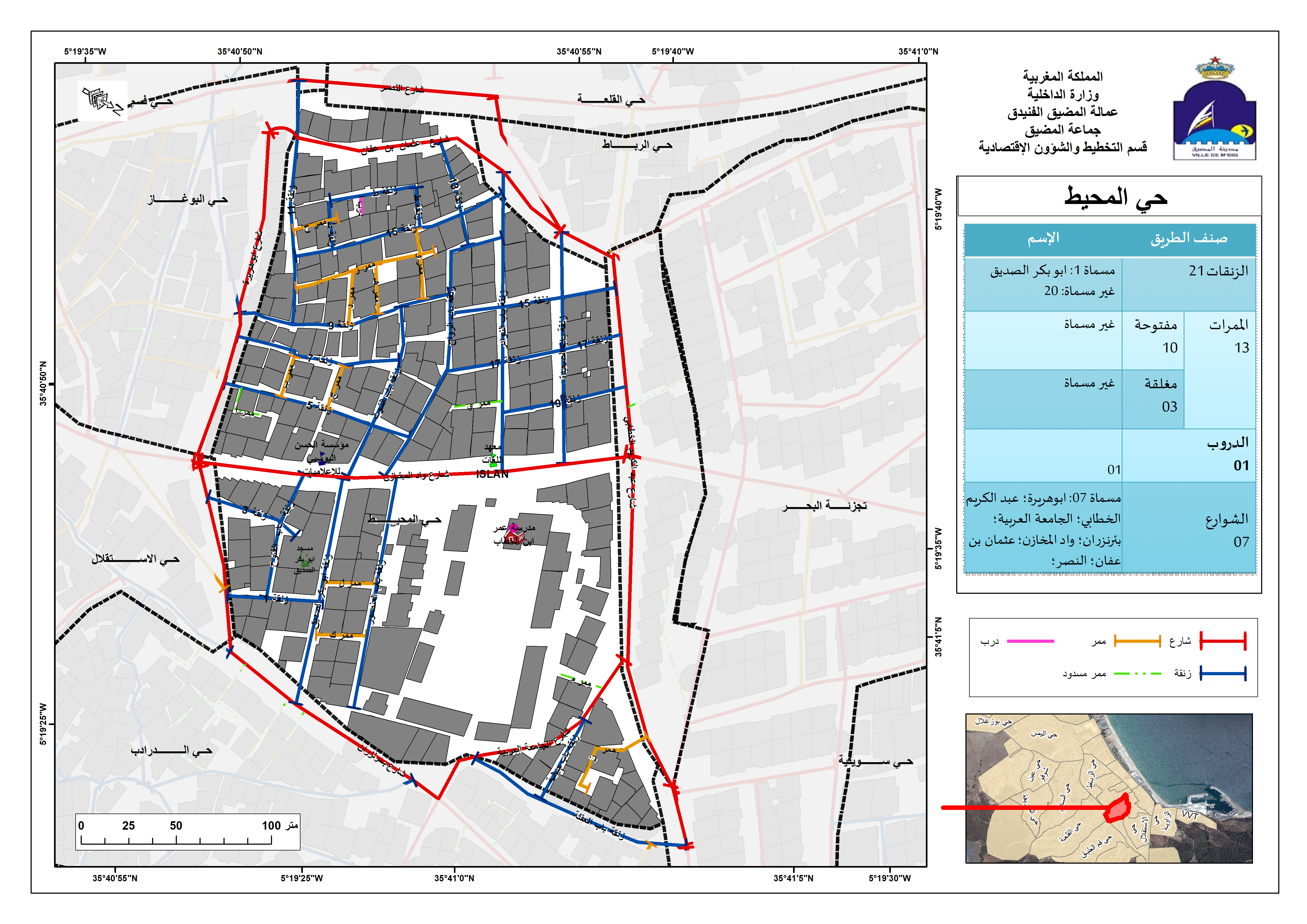

Street Addressing and Naming System
Spatial analysis
Spatial analysis
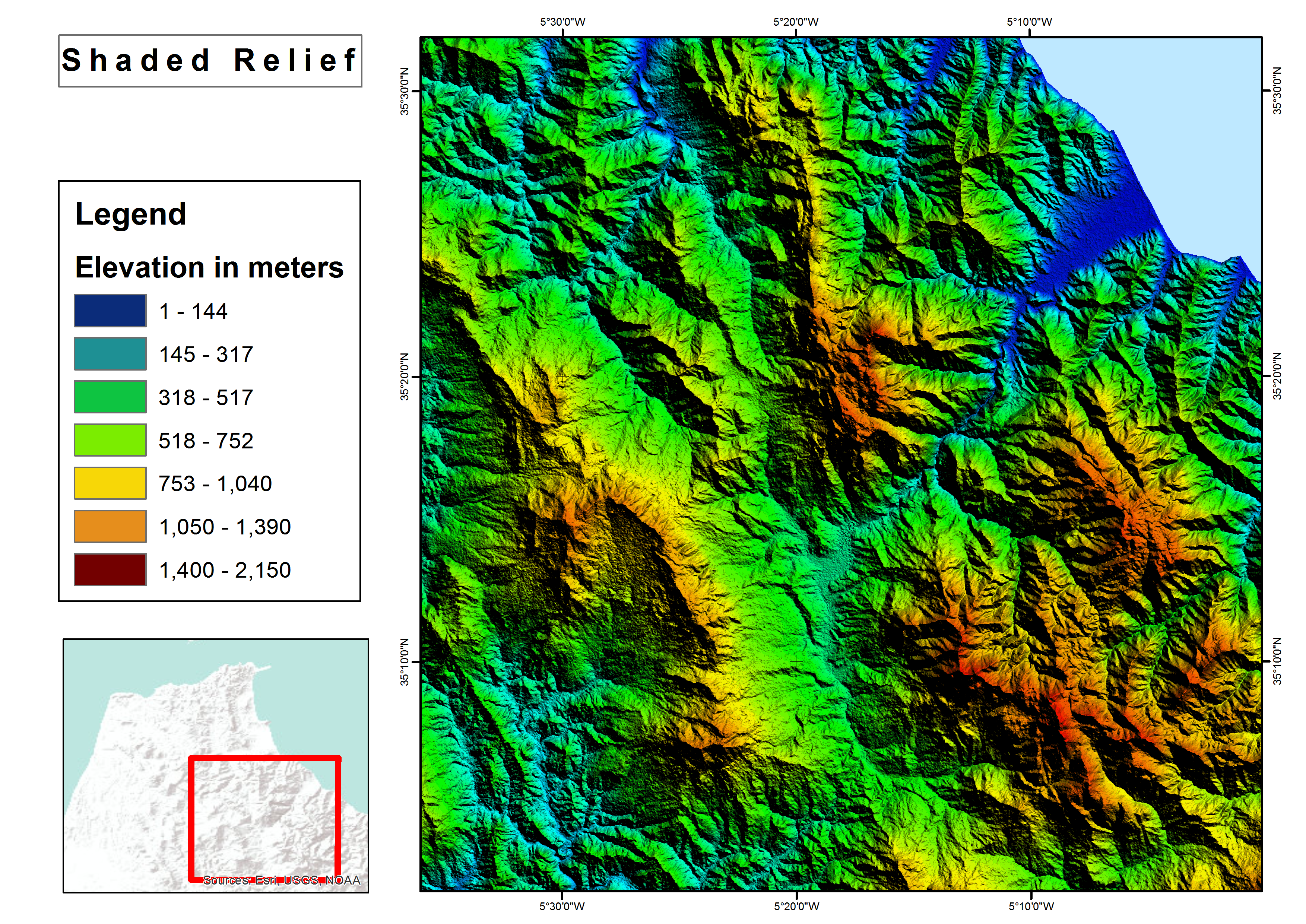
Shaded relief map
Raster to Geodatabase
Thematic maps
Thematic maps
Thematic maps
Thematic maps
Brochure with Business Card
Brochure with Business Card
Street Addressing and Naming System
Valutazioni
Modifiche salvate
valutazioni 1 - 5 di 9 mostrate
$150,00 USD
Data Processing
Data Mining
Geospatial
JSON

•
€40,00 EUR
N

•
$10,00 USD
PHP
Data Processing
Data Entry
Excel
Web Scraping
A
•
€90,00 EUR
N
•
$50,00 USD
Logo Design
Illustrator
Prezi
Geospatial
+ 1 altro

•
Esperienza
GIS Specialist
gen 2018 - Attualmente
• Performed geospatial analyses;
• shared interactive maps and services in ArcGIS Online;
• Collected and processed Landsat images for M’diq city;
• Used GIS technique (Desktop/Mobile) and Microsoft Access in business activities survey;
• Mapped a land use plan for M'diq-Fnideq prefecture beach;
• Designed billboards for Beach;
• Created Gis-based Street Addressing and Naming System;
• Mapped a Traffic Signs plan for M’diq city;
• Created compelling visual presentations.
Cartographer/GIS
gen 2017 - giu 2017 (5 mesi, 1 giorno)
Designed land use plan using Geographical Information System.
GIS Intern
ago 2016 - set 2016 (1 mese, 1 giorno)
Created Geodatabase for Guelmim-Oued Noun Regional Roads.
Formazione
Master's degree, Territorial Development and Spatial Governance
(3 anni)
Bachelor's degree, Geography
(3 anni)
Contatta Ayoub L. per il tuo lavoro
Accedi per discutere i dettagli via chat.
Verifiche
Competenze principali
Cerca freelance simili
Cerca vetrine simili
Invito inoltrato!
Grazie! Ti abbiamo inviato tramite email il link per richiedere il tuo bonus gratuito.
Non è stato possibile inviarti l'email. Riprova per piacere.
Impossibile copiare negli appunti. Riprova dopo aver modificato le tue autorizzazioni.
Copiato negli appunti.
Caricamento anteprima
Autorizzazione per la geolocalizzazione concessa.
La tua sessione è scaduta ed è stato effettuato il log out. Accedi nuovamente per piacere.