
Stai seguendo
Impossibile seguire l'utente.
Questo utente non consente agli altri utenti di seguirlo.
Stai già seguendo questo utente.
Il tuo piano di abbonamento ti consente un massimo di 0 segui. Cambia abbonamento qui.
Non segui più
Impossibile non seguire più l'utente.
Hai consigliato .
Impossibile consigliare l'utente.
Si è verificato un problema. Aggiorna la pagina e riprova per piacere.
Email verificata.

dhaka,
bangladesh
Attualmente sono le 11:59 AM qui
Registrato il giugno 8, 2020
0
raccomandazioni
Abhijit B.
@abhijitbsws467
2,5
2,5
100%
100%
dhaka,
bangladesh
88%
Lavori completati
92%
Nel budget
92%
Nei tempi previsti
10%
Tasso di riassunzione
GIS Specialist
Contatta Abhijit B. per il tuo lavoro
Accedi per discutere i dettagli via chat.
Portfolio
Portfolio

Symbolization

Symbolization

Symbolization
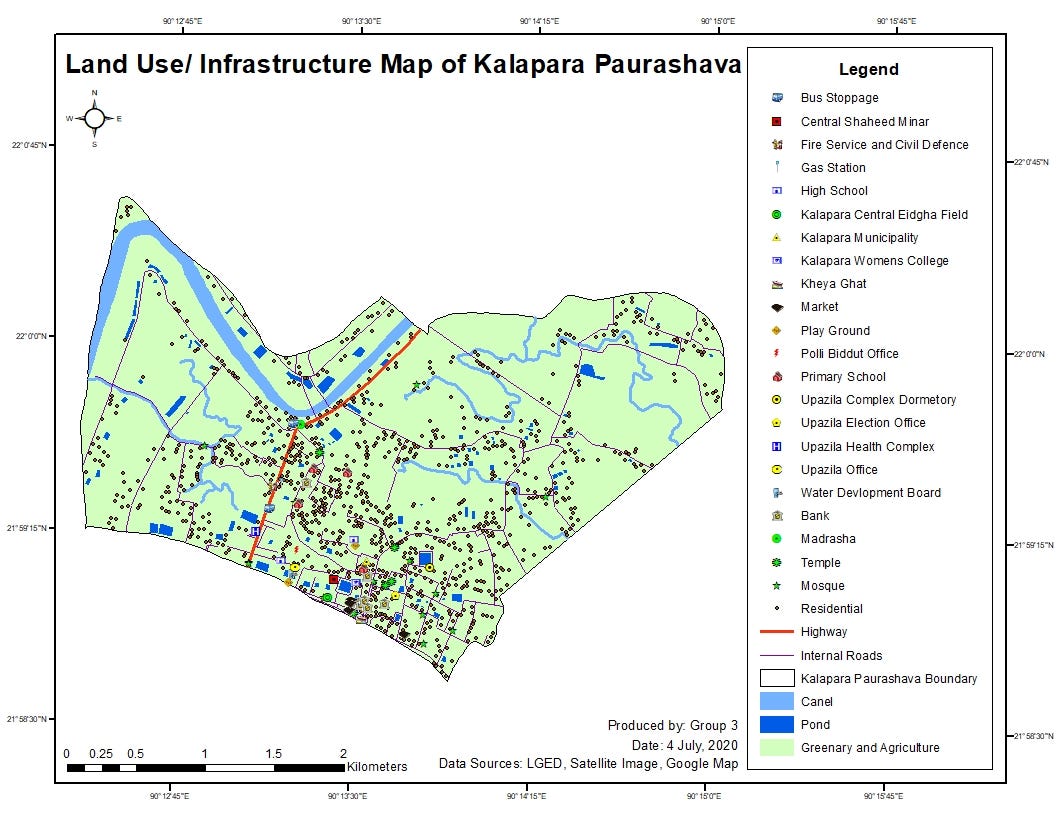

Map Digitization

Map Digitization

Map Digitization

Map Digitization

Map Digitization
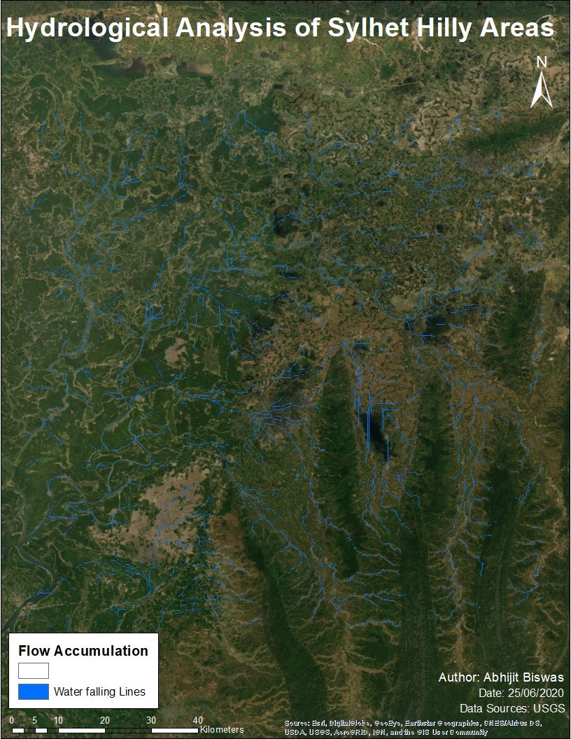

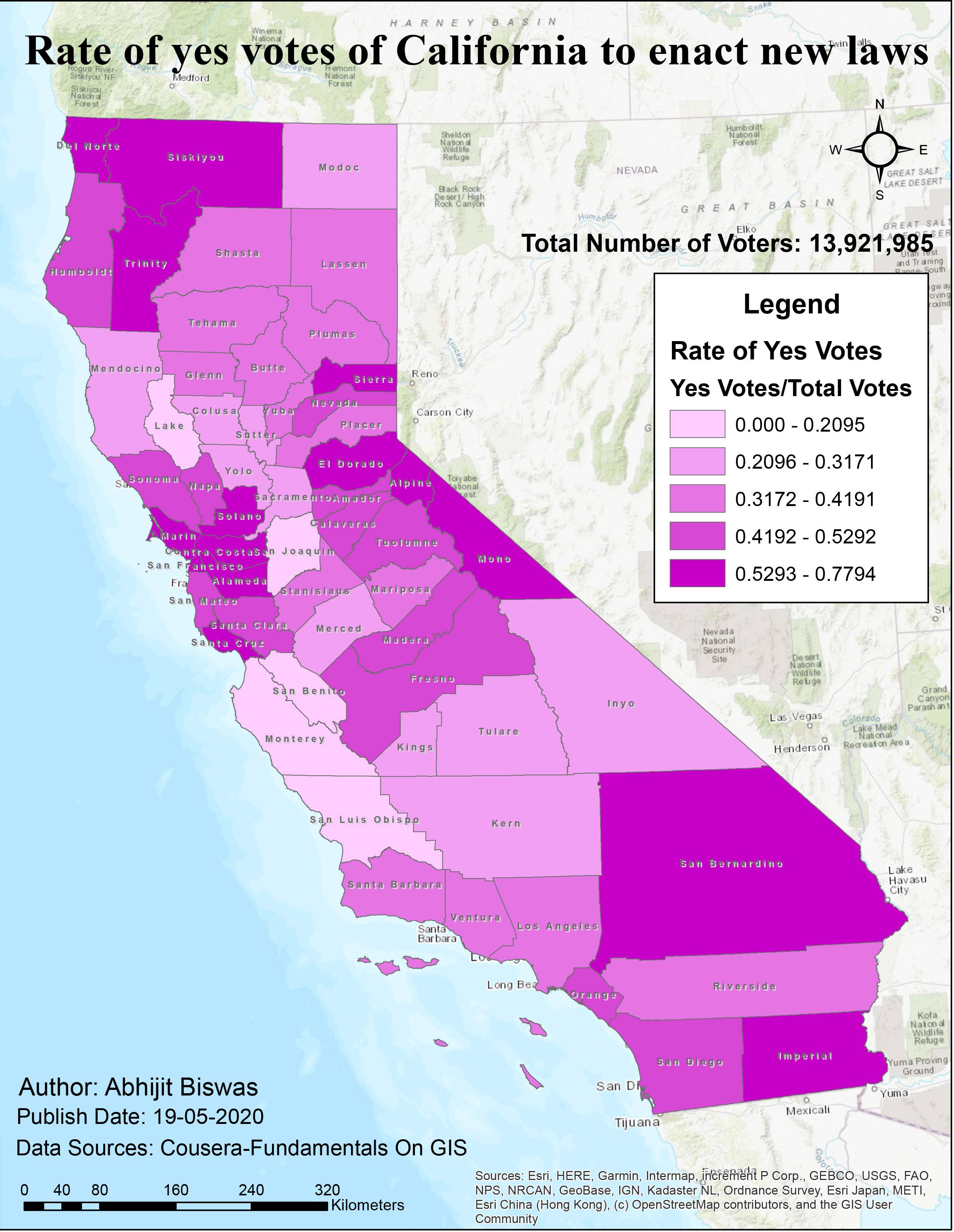
Hydrology Analysis.
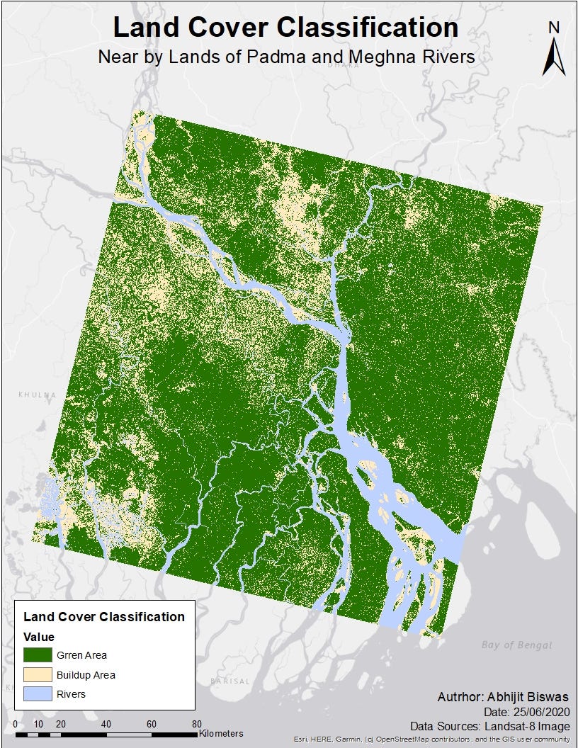

Satellite Imagery Analysis
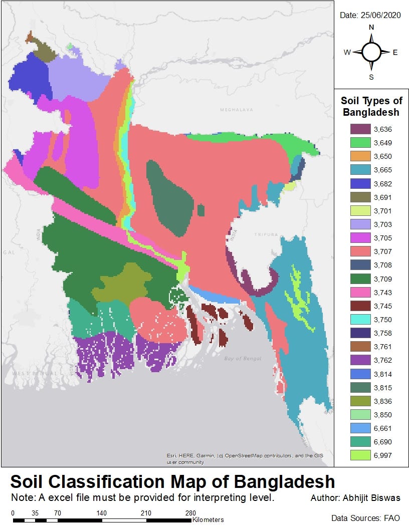

Soil Analysis
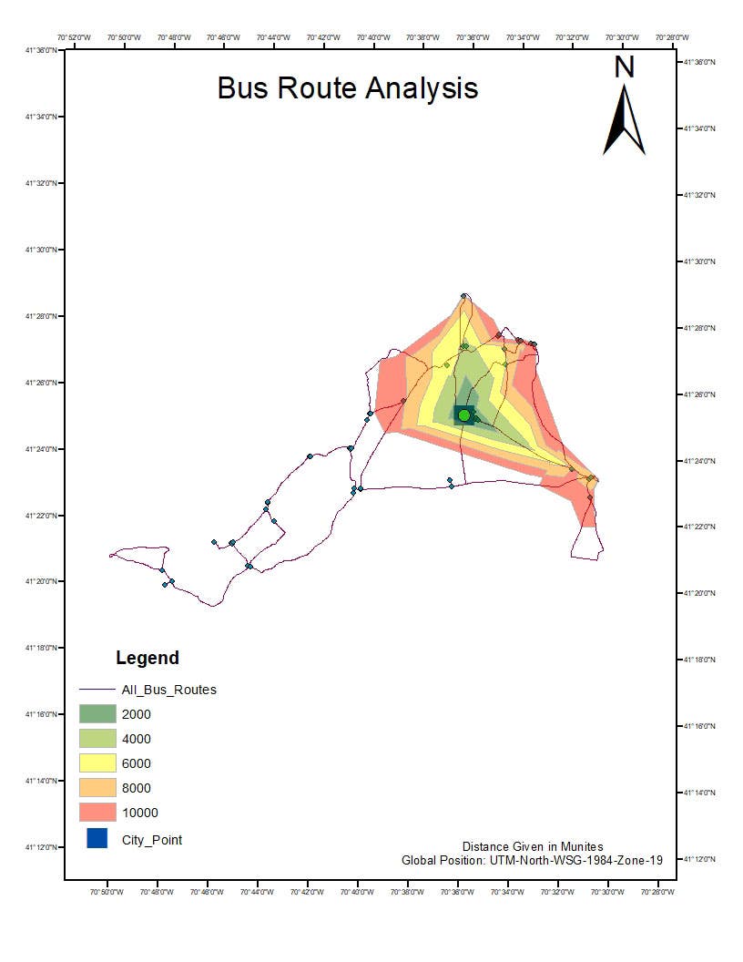

Network Analysis using GIS
Symbolization
Symbolization
Symbolization
Map Digitization
Map Digitization
Map Digitization
Map Digitization
Map Digitization
Hydrology Analysis.
Satellite Imagery Analysis
Soil Analysis
Network Analysis using GIS
Valutazioni
Modifiche salvate
valutazioni 1 - 5 di 8 mostrate
$100,00 USD
Geolocation
Google Earth
Geospatial
Google Maps API

•
$70,00 USD
Data Processing
Excel
Cartography & Maps
Google Earth
Geospatial
E
•
$7,00 USD
Data Processing
Data Entry
Cartography & Maps
Geographical Information System (GIS)
+ 1 altro
•
$20,00 AUD
Cartography & Maps
L

•
$29,00 USD
A
•
Esperienza
Intern
nov 2019 - dic 2019 (1 mese, 2 giorni)
GIS Annalist.
Formazione
Bachelor of Urban and Regional Planning
(4 anni)
Certificati
Professional Training on GIS
Dhaka University
2020
It is a advanced GIS Course.
Spatial Analysis and Satellite Imagery in GIS
Coursera
2019
It is a Advanced GIS Course
Introduction to GIS
Coursera
2019
It is a Basic GIS Course.
Contatta Abhijit B. per il tuo lavoro
Accedi per discutere i dettagli via chat.
Verifiche
Competenze principali
Cerca vetrine simili
Invito inoltrato!
Grazie! Ti abbiamo inviato tramite email il link per richiedere il tuo bonus gratuito.
Non è stato possibile inviarti l'email. Riprova per piacere.
Impossibile copiare negli appunti. Riprova dopo aver modificato le tue autorizzazioni.
Copiato negli appunti.
Caricamento anteprima
Autorizzazione per la geolocalizzazione concessa.
La tua sessione è scaduta ed è stato effettuato il log out. Accedi nuovamente per piacere.