

Stai seguendo
Impossibile seguire l'utente.
Questo utente non consente agli altri utenti di seguirlo.
Stai già seguendo questo utente.
Il tuo piano di abbonamento ti consente un massimo di 0 segui. Cambia abbonamento qui.
Non segui più
Impossibile non seguire più l'utente.
Hai consigliato .
Impossibile consigliare l'utente.
Si è verificato un problema. Aggiorna la pagina e riprova per piacere.
Email verificata.

pancevo,
serbia
Attualmente sono le 10:36 AM qui
Registrato il aprile 30, 2007
2
raccomandazioni
Darko J.
@ReflectColor
6,3
6,3
91%
91%
pancevo,
serbia
96%
Lavori completati
100%
Nel budget
100%
Nei tempi previsti
19%
Tasso di riassunzione
Code Development | Google Maps | GIS
Contatta Darko J. per il tuo lavoro
Accedi per discutere i dettagli via chat.
Portfolio
Portfolio


Google Maps & Fusion Tables

Google Maps & Fusion Tables
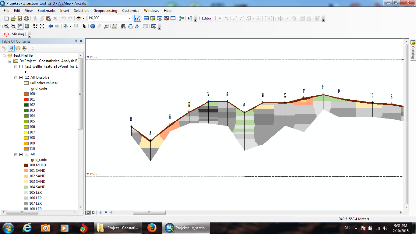

GIS (ESRI ArcGIS and ArcScene software)
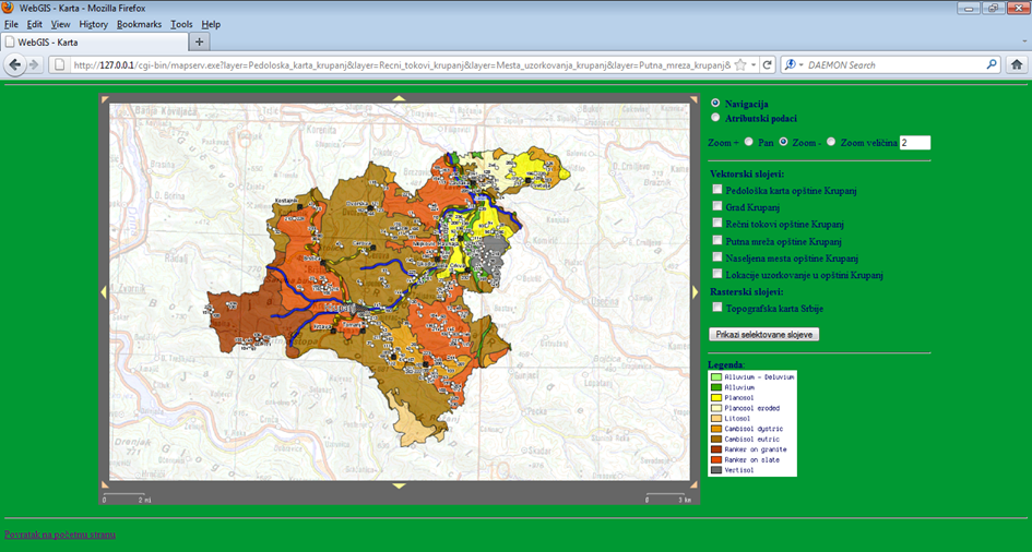

MapServer & PostgreSQL/PostGIS & MS SQL server
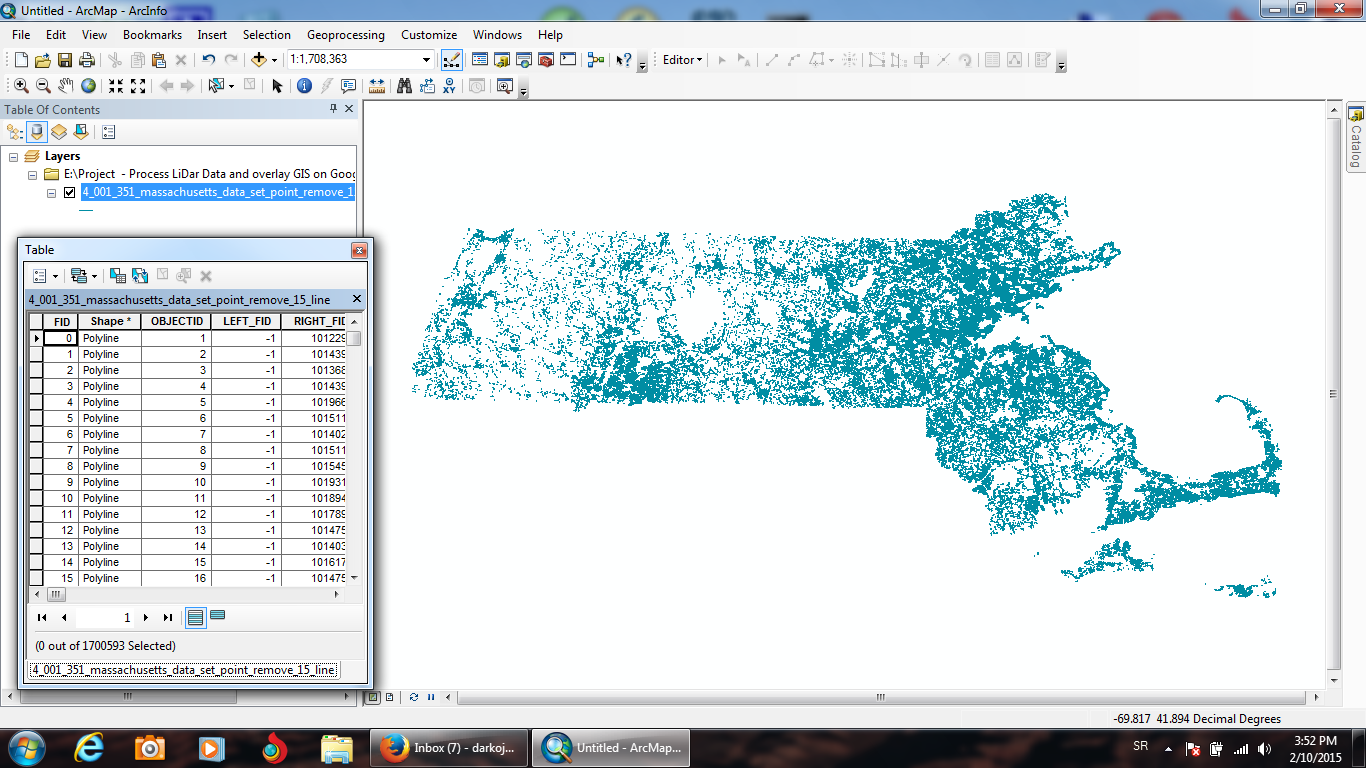

Remote Sensing & PostgreSQL/PostGIS & Google Maps
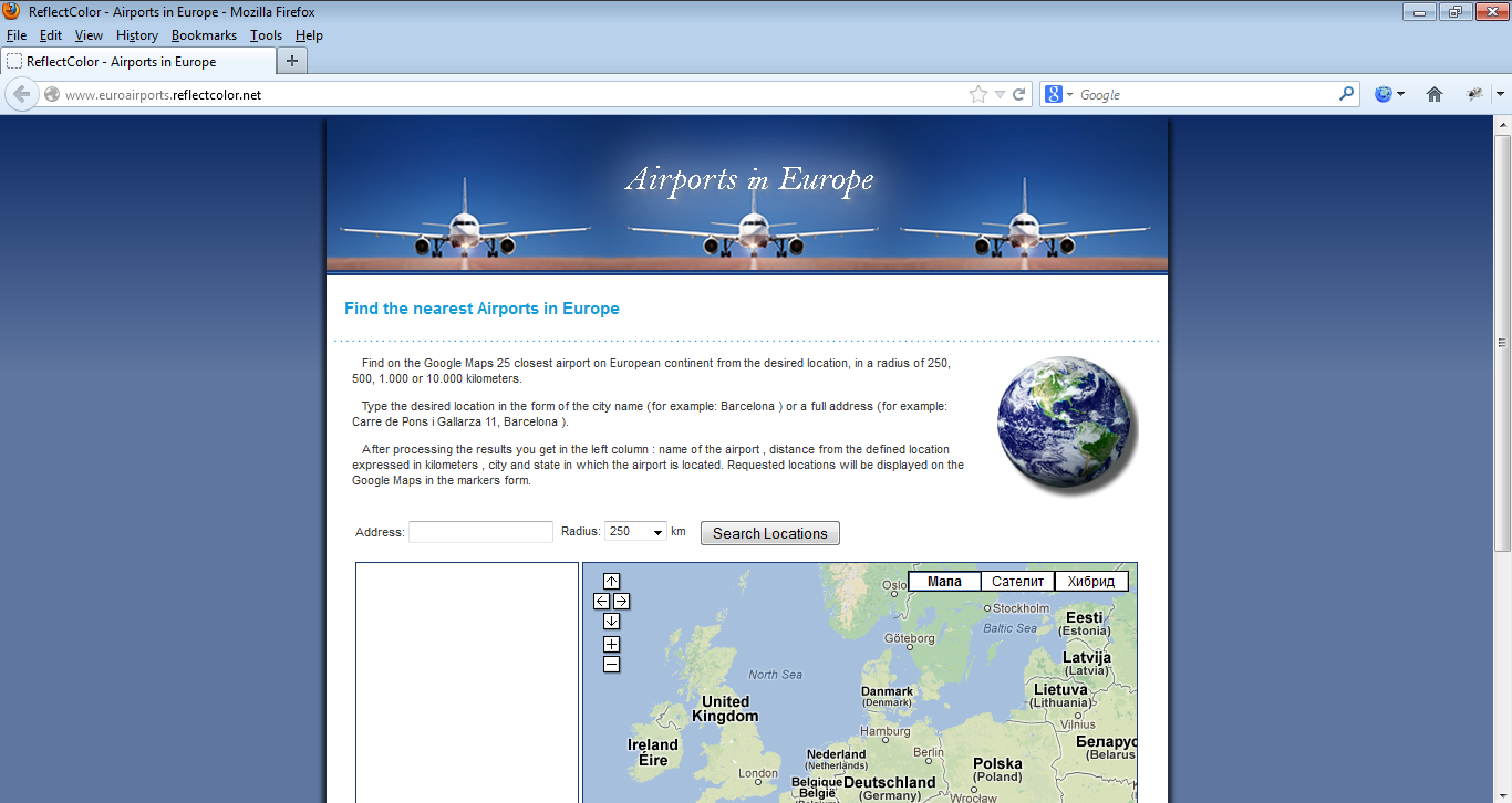

Google Maps & PHP & MySQL
Google Maps & Fusion Tables
Google Maps & Fusion Tables
GIS (ESRI ArcGIS and ArcScene software)
MapServer & PostgreSQL/PostGIS & MS SQL server
Remote Sensing & PostgreSQL/PostGIS & Google Maps
Google Maps & PHP & MySQL
Valutazioni
Modifiche salvate
valutazioni 1 - 5 di 38 mostrate
$120,00 USD
Cartography & Maps
Geolocation
GPS
Geospatial
B

•
$578,91 USD
PHP
Cartography & Maps
MySQL
Geolocation
+ 1 altro
G

•
$100,00 USD
PHP
Cartography & Maps
MySQL
Geolocation
+ 1 altro

•
$400,00 USD
Python
Software Architecture
Cartography & Maps
NoSQL Couch & Mongo
Geospatial
•
$326,41 USD
Cartography & Maps
Geospatial
ASP.NET
Microsoft SQL Server
Google Maps API
S
•
Formazione
M.Sc. Information Systems and Technologys (Faculty of Organizational Sciences)
(2 anni)
Certificati
Master's degree in Information Systems and Technology
Faculty of Organizational Sciences, University of Belgrade
2011
Pubblicazioni
Application of USLE, GIS, and Remote Sensing in the Assessment of Soil Erosion Rates in Southeastern Serbia
Polish Journal of Environmental Studies
The assessment of soil erosion rate and its spatial distribution in the hilly-mountainous Nisava River basin was conducted by Universal Soil Loss Equation (USLE) model through a GIS-based approach. A Landsat 7 Enhanced Thematic Mapper (ETM+) image and normalized difference vegetation index (NDVI) were used for the determination of crop management factor. The average annual soil loss was estimated at 13.1 t·ha-1·yr-1, classifying the Nisava River basin under the high erosion rate category. Abou
Spatial modelling of soil erosion potential in a mountainous watershed of South-eastern Serbia
Springer
This work aims at the assessment of soil erosion rate and its spatial distribution in hilly mountainous Nisava River Basin (South-eastern Serbia) with a surface area of approximately 2,848 km2. The study was conducted using Universal Soil Loss Equation (USLE) model due to its modest data demand and easy comprehensible structure. The erosion factors of USLE were collected and processed through a GIS-based approach. Landsat 7 Enhanced Thematic Mapper (ETM+) image and normalized difference vegetation index (ND
Contatta Darko J. per il tuo lavoro
Accedi per discutere i dettagli via chat.
Verifiche
Certificazioni
Competenze principali
Cerca vetrine simili
Invito inoltrato!
Grazie! Ti abbiamo inviato tramite email il link per richiedere il tuo bonus gratuito.
Non è stato possibile inviarti l'email. Riprova per piacere.
Impossibile copiare negli appunti. Riprova dopo aver modificato le tue autorizzazioni.
Copiato negli appunti.
Caricamento anteprima
Autorizzazione per la geolocalizzazione concessa.
La tua sessione è scaduta ed è stato effettuato il log out. Accedi nuovamente per piacere.